ZRR setdown report submitted to Office of Zoning Reply

The Zoning Regulations need substantial revision and reorganization, ranging from new definitions to updated development and design standards, and even new zones.
Comprehensive Plan for the National Capital: District Elements (IM-1.3)

The Office of Planning has submitted its setdown report to the Office of Zoning. The Zoning Commission is expected to consider this report at its public meeting on September 9, 2013. The report discusses scheduling of the public hearings, public testimony, and how additional OP reports will be structured and submitted prior to each hearing. The report notes that the version of the draft report that the Commission will receive at the setdown meeting will be considered the final version for advertising – this is the document that will be reviewed at the public hearings. Until that time, as noted in all of our postings to date and as discussed with the Zoning Commission, it remains a working document and we continue to make corrections where needed, including ones brought to our attention by other District agencies and members of the public as they review the working copy. These changes are noted in “errata” sheets posted on our website.

The report includes additional background information, summarizing the process to date; Comprehensive Plan guidance; Zoning Guidance (48 pages worth) already received at 19 public hearings and 40 public meetings; public outreach, including over 100 ANC, community, and stakeholder meetings; and a bit of a “snap shot” of the District. A summary of the proposed changes, organized by existing zoning regulation chapters, is provided. The summary does not discuss in detail the bulk of the regulations that are not proposed to change. If the Zoning Commission does set the proposal down for hearings, OP will provide a more detailed summary organized by subtitle of the new regulations, in advance of each hearing.

The complete report is available on the ZRR website – www.dczoningupdate.org and on the Office of Zoning website, www.dcoz.dc.gov.

New zoning codes – the District is not alone (part III) Reply

Part 3 of our “the District is not alone” series, where we head down south to beautiful Miami.

Miami’s new code, dubbed “Miami 21,” was developed over a period of five years and included over 500 public meetings before finally being implemented in 2010. Of the three codes examined for this blog post, Miami 21 most radically differs from the District’s ZRR in that it is the largest and most comprehensive example of a form-based code in the nation. Form based codes are predicated on physical form rather than on use. Prior to Miami 21, Miami’s zoning code was a conventional “Euclidian” model, characterized by establishing and regulating land based on use (the District, like most jurisdictions in the US, uses the Euclidian model). According to the Form-Based Codes Institute, under certain circumstances form based codes allow for a dynamic mix of uses because its emphasis is on the appropriate form and scale (and therefore, character) of development, rather than on separating uses. However, some critics say that depending upon the quality of the code and its diagrams, form-based codes can be difficult to interpret and administer.

Downtown Miami (photo: Marc Averette)

Downtown Miami (photo: Marc Averette)


According to the Institute of Sustainable Communities, Miami’s prior code included antiquated parking requirements and inflexible separation between the places where people live, work, and shop. This resulted in automobile dependent communities, traffic congestion, and urban and suburban sprawl. Nancy Stroud, legal counsel to the team that created Miami 21, noted that a major impetus behind Miami’s decision to write a new code was to provide developers and residents with more predictability during the development process. Stroud says that in contrast to the prior code, which provided too much discretion to planning and council boards, Miami 21 simplifies the development process and makes it more transparent.

Miami 21 attempts to mitigate these issues and manage the city’s growth through the concept of transects, an idea promoted by planner/architects Andres Duany and Elizabeth Plater-Zyberk and the Congress for the New Urbanism (CNU) as an alternative or revision of conventional use based zoning. Their idea was to substitute conventional zoning’s focus on use with a focus on the relationship between the form and density of the built environment (a high rise is not appropriate in the middle of the wilderness, just as a single-family bungalow makes no sense in the middle of Manhattan). A transect is a sliding scale between rural wilderness and dense central cities; it defines a series of zones that transition from sparse rural farmhouses to the dense urban core. The transect manages the relationships of buildings to the streets, to open space, and to each other. Miami 21 uses the transect model to enhance neighborhood character and walkability through emphasis on concentrating development along transportation corridors, neighborhood centers, and urban cores.

More…

New zoning codes – the District is not alone (part II) Reply

Part 2 of a series looking at a few of the other cities undergoing a zoning code revision. Today, we are off to Baltimore!

Baltimore’s proposed new code, dubbed “TransForm Baltimore,” rewrites Charm City’s existing 40 year old code. The city’s existing zoning code was developed by a commission appointed in 1957 and was eventually approved in 1971. It followed a suburban model– separating commercial and residential uses. According to the Baltimore City Planning Department, the existing code is not only outdated, but is overly complex, with hundreds of overlay districts, Urban Renewal Plans and Planned Unit Developments. Understanding and working within these complexities is often expensive, time-consuming and unpredictable. For example, the existing code does not readily permit the creation of new mixed-use developments — it can often take months or years of administrative maneuvers and an act of City Council to convert an old industrial building to a mixed-use residential/commercial space.

Baltimore's Inner Harbor (photo: Jawed Karim) Baltimore’s Inner Harbor (photo: Jawed Karim)

TransForm Baltimore was approved by the city’s Planning Commission in April 2013 and has been sent to Baltimore City Council for approval. The new code is designed to be easier to use and understand, more predictable and enforceable. The goals of Transform Baltimore include:
• Increasing user-friendliness;
• Improving administration;
• Modernizing use structure;
• Incorporating urban design objectives;
• Preserving neighborhood character while promoting appropriate redevelopment;
• Ensuring coordination with the Comprehensive Plan;
• Integrating Urban Renewal Plans; and
• Promoting sustainable development.
More…

New zoning codes – the District is not alone Reply

What do Boulder, Chicago, Denver, Fort Collins, Miami, Milwaukee, Philadelphia, San Antonio, and St. Petersburg have in common with the District of Columbia? The answer is that these cities either recently completed, or substantially updated, their existing zoning codes. In addition to those cities, Baltimore is currently nearing the finish line for its major zoning rewrite, and Los Angeles has recently started to update its code. Is there a reason behind this seeming rash of new codes?

As is the case in the District, the previous zoning codes in these cities were decades old and unwieldy. Most of the codes were written in the years following World War II, when separating land uses was all the rage (in many cases, the encroachment of “noxious” uses into residential areas led to zoning restrictions which separated residential, commercial and manufacturing uses). In recent years, these old codes have proved to be ill-suited to the needs of evolving cities:

• The American economy has largely transitioned away from heavy manufacturing, removing many of the noxious uses from many cities.

• Mixed-use zoning is increasingly prevalent in American cities and many residents want to live near where they work and shop.

• Attitudes toward the private automobile are changing. The lynch-pin of many existing zoning codes was the supremacy of the private automobile, and zoning regulations (much like Federal and local transportation and land use policies in general) reinforced the notion that everyone should aspire to suburban living, which required an automobile to meet even the most basic of needs. Now, many people prefer to live a car-free or car-light lifestyle because there are a wider variety of transportation options, to be more environmental friendly, or just to save the expense and bother of car-ownership.

• Finally, there is the changing demographics of the country, with more retirees and recent graduates seeking to live in walkable communities built as mixed use developments that would have been frowned on by the old codes.

In revamping their codes, these jurisdictions used somewhat differing approaches specifically suited to each place — from conventional use-based zoning to form-based codes that replace use districting with design controls. However, the common link is that these cities sought to replace unclear and antiquated codes with streamlined versions which better allow for mixed-use, pedestrian-friendly, and transit-oriented development.

A few of the most recently developed codes, including those created by Philadelphia, Baltimore, and Miami, merit a closer look. Over the next few days, we are going to post a summary of each. First up in this series – Philly!

zoning_in_other_cities_table
More…

Draft ZRR text delivered to Zoning Commission Reply

Last night, OP delivered a copy of the draft proposed zoning regulations to the Zoning Commission. It was their last public meeting before they break for August, and we wanted to make sure they had some nice light reading for the summer. We have posted a copy of the text that was delivered here. We continue to work on the document and expect to post updated Subtitles over the course of the summer. We’ll also be posting “background pieces”, discussing the draft, and what is – and is not – proposed to be changed in the draft.

In the meantime, we want to thank all of you who attended one or more of our 82 working group meetings; 112 community and ANC meetings; or 24 Zoning Commission meetings or hearings (so far). Thanks also to everyone who discussed the Zoning Review process in their blogs, tweets, articles, or conversations with neighbors. In particular, we would like to thank the Task Force members, who have assisted in this effort since 2007 at 41 meetings. We feel that the document that we submitted to the Zoning Commission is better because of your involvement.

The Zoning Commission indicated at the meeting last night that at its first meeting in September, they expect to consider setting down the proposed draft for public hearings later in the fall. We encourage people to stay involved – watch our website and blogsite and the Office of Zoning website for additional postings, including the dates of future Zoning Commission meetings and hearings on this important initiative.

An update on parking proposals, part II 5

Last week, OP noted that we are revising our proposed parking requirements; a reexamination based on the comments we received as part of our extensive public process, and a reevaluation of how new parking standards could and should be implemented. Many people have commented on this, and a few people have contacted us to get more information on this new draft text.

Well, we are still working on the actual text, but below is a summary of what we are working on. Some of the provisions are different; some will look familiar because we are not proposing to change them. Of course, this is a work in progress; aspects may change by the time the draft text is complete but we wanted you to know where we are headed.

Summary of current proposal:

Eliminate separate transit zone text. This means that, unlike in earlier proposals, all parking regulations would be adopted as a comprehensive part of this ZRR process, not requiring additional, subsequent processes to map and implement separate transit zones.

• For any use, allow 50% by-right reduction in required parking for sites located close to transit (1/2 mile from a metro station, or ¼ mile from a streetcar line or WMATA bus route identified as part of the Priority Corridor Network).

Low density residential zones: retain existing one space per lot requirement; except no on-site parking would be required where there is no alley access.
   o Strong neighborhood concern about total elimination of requirement; likely to have minimal impact as providing on-site parking is standard practice.
   o Addresses properties that cannot access parking from an improved alley; new curb cuts eliminate street parking (no net gain), negatively impacts streetscape character, can result in loss of street trees, and can create safety issues.

Multi-family residential: standardize minimum parking requirement of 1 / 3 units greater than 4 units, and
More…

An update on parking proposals Reply

You may have heard that OP is changing the parking proposal that it will be bringing forward to the Zoning Commission. Yes, we are proposing to step back from the transit zone concept, areas within which there would be no minimum parking requirement. This proposal received a lot of support from some residents, and equally as much opposition from other residents at our many community meetings. That’s OK – achieving consensus when it comes to parking is unlikely.

So what are we proposing? Well, we are still finalizing the details, but will be taking a proposal forward to the Zoning Commission that:
• Continues to propose that the expanded downtown have no minimum parking requirement.
• As in the previous draft, proposes decreasing parking minimums, with additional by-right reductions for areas that are proximate to mass transit.
• Allows for reductions in required parking by special exception (rather than the current variance process).
• Examines better connecting parking to more effective transportation demand management programs.

Why would OP change its parking proposal now? First, we have been refining many of our proposals, over time, as we conduct additional research and hear from more residents. Second, in the case of parking minimums, we feel that a parking proposal that can be implemented more efficiently and more quickly is a better tool to address DC parking policy. Remember, the transit zones that were being proposed would not actually have been mapped anywhere in the city until after the ZC adopted language enabling them. OP would then work with neighborhoods and ANCs to discuss boundaries and where transit zones should actually be applied – i.e. a separate process with separate public meetings and Zoning Commission hearings after ZRR is completed. OP’s revised parking proposal would be effective with the adoption of the revised zoning regulations. Third, we are trying to respond to the City of today – one where many people want or need to drive and one where we have a wealth of transportation options, including great public transit, bike share, car share, and walkable neighborhoods that allows residents to live a car free or “car light” lifestyle.

The proposal we take to the Zoning Commission will be based on direction contained in the Comprehensive Plan and guidance provided by the Zoning Commission. And, we anticipate that any regulations adopted by the Zoning Commission could look different than the OP proposal and will be further shaped by community input through the Zoning Commission hearing process.

We know you are interested in the details and we will continue to post updates here on the blog. The revised parking proposal will be posted on our website, with a link from this blog, before the draft regulations are submitted to the Zoning Commission on July 29.

Revised Residential House and Residential Flats draft subtitles now available Reply

Revised drafts of Subtitle D Residential (R) House and Subtitle E Residential Flats(RF), are now available on ZoningDC, as well as the PowerPoint presentation from the June 19th Task Force meeting describing these two subtitles.

The draft subtitles consolidate a lot of the information in one place and include improved tables to make it easier for users to find a relevant section of the code. This might reduce the need to flip back and forth between chapters. For example, you can find the bulk regulations (height, setbacks, etc.) and use permissions for a zone within one Subtitle.

OP also refined aspects of the proposed draft text in in response to feedback received from residents and other District agencies. Accessory apartments (accessory dwelling units) would be permitted subject to the following conditions:
1) Only one per lot;
2) By right in the principal dwelling up to 30% of the gross floor area (current code permits 25% of GFA);
3) By right in an existing accessory building provided there is:
a) Permanent access to a public street that meets the following:
i) 24-foot alley or 10-foot clear side yard easement; and
b) No expansion of or addition to the existing accessory building.

All other accessory apartments would be permitted by special exception.

Other proposed changes pertain to corner stores. Corner stores are currently not permitted unless they have a current, valid Certificate of Occupancy. In the proposed draft text, new corner stores such as retail, arts-related, or eating and drinking establishments would be permitted in the R-3 and R-4 zones by special exception, which would include a hearing before the Board of Zoning Adjustment. Grocery stores would, however, be permitted by right subject to conditions.
Corner Store 2
More…

Introducing front setbacks 1

Many cities have a front yard setback requirement, at least for low density residential areas. Washington DC does not. Why?

First – what is a front yard setback? Typically, it is a requirement that the house and other buildings be set back a certain distance from the front or street property line. DC has setback requirements, depending on the zone, from rear and side property lines, but not from the front. However, there typically is a landscaped area separating the house from the sidewalk, even in our denser rowhouse areas. This landscaped space between the sidewalk and the property line is confusingly called “parking” area (not car parking space), and is legally part of the city’s park and open space system.

So, how did this come to be?

DC’s streets are typically quite wide (yes, we know that there are some exceptions). We can thank Pierre L’Enfant for this. The 1791 L’Enfant Plan that established the street network within the boundaries of Florida Avenue to the north and the confluence of the rivers to the south had rights-of-way that ranged in width from 90 to 160 feet. The idyllic notion that the broad avenues would be picturesque carriage ways lined with double rows of trees was a nice idea. But in reality these wide streets presented a maintenance headache for the fledgling city and local government. To help the city deal with this, in 1870 Congress passed the Parking Act, which allowed the city to set aside parts of the street right-of-way as park land “to be adorned with shade-trees, walks, and enclosed with curbstones, not exceeding one half the width of any and all avenues and streets in the said city of Washington”.
More…

GAR – easier than you might think? Reply

At first glance, meeting the District’s proposed Green Area Ratio (GAR) requirement might seem like a daunting proposition. Fear not, satisfying the GAR requirements will not be as difficult as you think. The GAR is a way for the District to ensure, through the zoning code, that new projects and significant additions meet minimum environmental standards. The GAR requirements work in tandem with the District Department of the Environment (DDOE) and the Environmental Protection Agency’s (EPA) new stormwater management requirements (MS-4). Together, GAR and MS-4 require property owners to incorporate landscape elements and environmental site design components into their projects to reduce stormwater runoff, improve air quality, and mitigate the urban heat island effect. Do these new requirements (GAR and MS-4) mean that site design has to be approached in a new way? In some cases, absolutely, but the intent is to encourage designers to approach site design in a holistic way; improving the District’s environmental quality while simultaneously satisfying the GAR and MS-4 requirements.

First, let’s review some basic information about GAR applicability. GAR would not apply to one-family detached and semi-detached dwellings, although they are required to provide a certain percentage of pervious surface on the lot. If you live in an R-1, R-2, R-3, or R-4 zone, GAR would not apply.

Second, let’s try to address some concerns that have been expressed about GAR. We’ve heard people say that the GAR might conflict with other planning goals, such as creating lively and engaging streetscapes, and could instead result in sites with overly large setbacks. However, the GAR requirement could be met while still allowing for effective site design while including project elements consistent with the District’s planning goals, such as pedestrian plazas that include public seating, cafe seating and retail opportunities. Examples exist where landscape performance features have been incorporated into designs that accommodate both gathering spaces and green features.

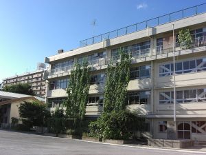
Example of a vegetated wall in Tokyo

Example of a vegetated wall in Tokyo

Extensive green roofs have been installed under walking grates at the American Society of Landscape Architects’ downtown headquarters. University of the District of Columbia’s Van Ness campus has incorporated an intensive green roof and commencement gathering areas, as well as a harvest/reuse system, into the main pedestrian plaza over the parking structure. In addition, there are several other ways designers could meet the GAR requirement, including the use of permeable pavers, vegetated walls, or planters with trees or native plant species.

More…